Seismic waves are elastic waves which propagate across the Earth's surface and interior following an earthquake.
They appear when an initial impulse send particles into motion, which in turn will cause the matter with which they are in contact to move before returning to their original place. The phenomenon triggered can spread over tens, hundreds or even thousands of kilometres. These waves can be artificially generated for seismic studies.
Like all waves, they can be reflected or refracted when they travel from one layer to another (for instance between the mantle and the Earth's core).
Seismic waves are recorded by seismographs. The size of the waves is intrinsically linked to the magnitude of the earthquake.
(source: www.futura-sciences.com)
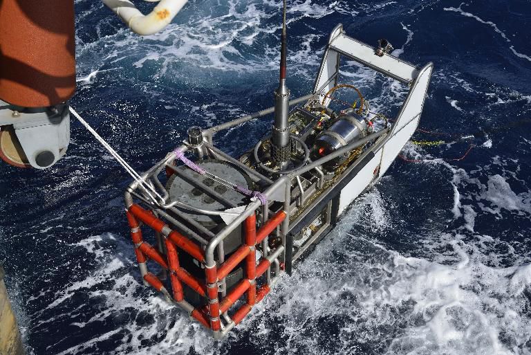
Seismic surveys are conducted by measuring the propagation time of artificially generated acoustic waves in the subterranean layers. This propagation time is used to determine the geometry and configuration of geological layers and thereby to learn more about the nature and structure of the sea floor.

©Ifremer - Stéphane LESBATS
What is measured and how?
Seismic surveys are a measurement technique which consists in recording at the surface the echoes generated by the propagation of an artificially-generated seismic wave through the subsoil.
There are two methods of measuring these echoes:
- Reflection: this method records the echoes of the waves reflected by the different layers in the subsoil (see left-hand diagram below).
- Refraction: this method records the echoes of waves refracted on the interfaces (areas of contact between two geological layers) of the different subterranean layers (see right-hand diagram below).
These propagation times are used to determine the spatial position of each layer or interface and thereby to understand the geometry, structure, configuration and nature of the different geological layers which make up the marine subsoil.

©Ifremer
There are 4 types of seismic survey systems: sparkers, air guns, water guns and sub-bottom profilers. They fall within a frequency range of between 1 kHz and 7 kHz. The first three are seismic processes (based on the analysis of the propagation of shock waves). Sub-bottom profilers are similar to bathymetric acoustic echosounders. These are the only systems that can be used very economically at high speed in the deep ocean and in rough sea conditions.
For a better understanding of how seismic equipment and acoustic devices (sediment echosounders) work, visit the Ifremer fleet website.
File types
File type |
Vessel/Vehicle |
Extension |
Version |
Date |
Format |
SEGY |
single-channel seismic profiling |
.sgy |
V1 |
- |
segy |
SEGD |
multi-channel seismic profiling |
.segd |
SEAL 358 |
- |
segd |
More information on file formats for geophysical data archived at SISMER.
Data processing and final results (products and synthesis)
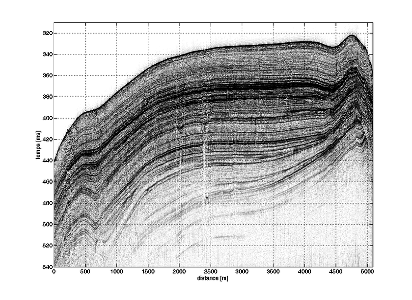
The aim of seismic data processing is to obtain "seismic profiles" or seismograms, which represent geological cross-sections of the marine sub-bottom layers. The main stages of seismic processing are as follows: characterisation of the signal to assess the quality of the recording and determine its frequency content; recentering of the signal, which can be offset in relation to the average; frequency filtering; elimination of noise in the water column; multiple attenuation, in particular for the sea floor.
For each seismic profile, the depth of seismic reflectors representing the different sediment layers is picked. A geometric reconstruction of the sediment layers is possible thanks to an interpolation calculated from these picks. The sub-bottom structures can thereby be represented.

Examples of sensors
- Side-scan sonar
- SAR since 1984
- Edgetech DF1000 since March 1999
- Positioning:
- terrestrial radio-electric systems: LORAN C, TORAN, SYLEDIS, etc.
- satellite radio-electric systems: TRANSIT + estimated until 1990, natural, differential and kinematic GPS since 1990.
More information on the website of the French oceanographic fleet.
Contact
For all further enquiries, please contact the SISMER service (sismer@ifremer.fr).
