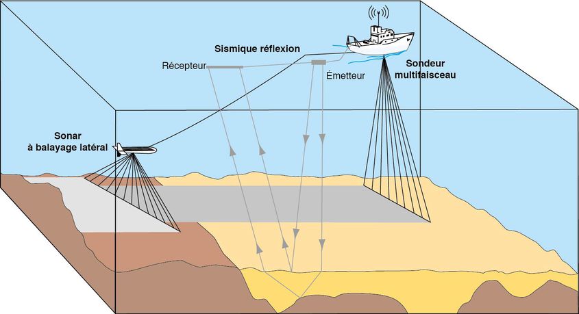
Acoustic imagery is a technique used to map the seabed. It is useful for obtaining accurate information on the morphology, relief and nature of the seafloor.
What is measured and how?
Acoustic imagery uses side-scan sonar. These systems use the acoustic backscattering properties of the bottom, i.e. the seabed's capacity to reflect acoustic waves according to their angle of incidence.
The backscattered energy changes according to the reflectivity of the seabed and its irregularities. It combines two effects:
- the effect of the seafloor surface (microtopography, roughness, etc.) which provides indications on the relief
- the volume effect related to the particle size, sensitive to the sediment's degree of porosity or compaction, which provides information of the nature of the seabed.
The energy of the backscattered waves is represented by 256 grey levels, which vary according to the different types of bottom. Two factors affect the variation in the intensity of grey: the sediment properties (which determine the reflectivity) and the topography of the seabed.
Find out about how side-scan sonar works and how multibeam echosounders work on the Ifremer fleet and marine geoscience webites.
Multibeam echosounders, used in bathymetry, also measure the reflectivity of the seabed and are based on the same principle.

File type
File type |
Vessel |
Extension |
Date |
Format |
MBES imagery - TECHSAS |
Pourquoi pas ? / Atalante |
- |
NetCDF |
More information on file formats for geophysical data archived at SISMER.
Processing and final results (products and synthesis)
Acoustic imagery mosaics are obtained from imagery data acquired by multibeam echosounders or by side-scan sonar. Each pixel in the mosaic corresponds to an area of seafloor associated with a given level of backscattering. Processing, performed by the CARAIBES software, is different for echosounders and sonar.
Image mosaics also provide accurate information of the relief of the seabed. The results of the analysis and interpretation of digital elevation models and acoustic image mosaics are presented as maps which illustrate the nature and morphology of the bottom, the distribution of fauna or the organisation of the components of the seafloor.
The scale of representation of this information varies depending on the acquisition devices used, the water depth and the size of the area studied. Geological surveys of areas located on the continental shelf, and in particular in inshore areas, can be used to draw maps at a scale of 1:20,000. A near-systematic review of the continental shelf and continental slope gives morphosedimentary results at a scale of 1:100,000.
Contact
For all further enquiries, please contact the SISMER service (sismer@ifremer.fr).
